


montagne des ruelles

bymarc26
User

Length
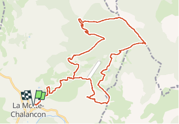
15 km

Max alt
1387 m

Uphill gradient
917 m
Km-Effort
27 km

Min alt
552 m

Downhill gradient
917 m
Boucle
Yes
Creation date :
2025-04-10 07:25:25.942
Updated on :
2025-04-19 12:11:18.665
4h35
Difficulty : Medium

FREE GPS app for hiking
 SityTrail
IGN / Geographical institutes
SityTrail Plus
The world is yours!
About
Trail Walking of 15 km to be discovered at Auvergne-Rhône-Alpes, Drôme, La Motte-Chalancon. This trail is proposed by bymarc26.
Photos

Positioning
Country:
France
Region :
Auvergne-Rhône-Alpes
Department/Province :
Drôme
Municipality :
La Motte-Chalancon
Location:
Unknown
Start:(Dec)
Start:(UTM)
689362 ; 4928632 (31T) N.
Comments